URGENT UPDATE: Hurricane-force winds are wreaking havoc across the Rockies and Midwest, with dangerous gusts reaching over 100 mph. These winds are now shifting eastward, impacting the Northeast as of Friday. Travelers and residents should prepare for possible disruptions, including power outages and hazardous conditions.
The storm, which has already knocked out power for nearly 750,000 utility customers from the Pacific Northwest to the northern Rockies, is moving rapidly. Winds clocked at 102 mph were recorded at Berthoud Pass, Colorado, and gusts hit 98 mph in Buffalo, South Dakota, prompting urgent safety warnings from local authorities.
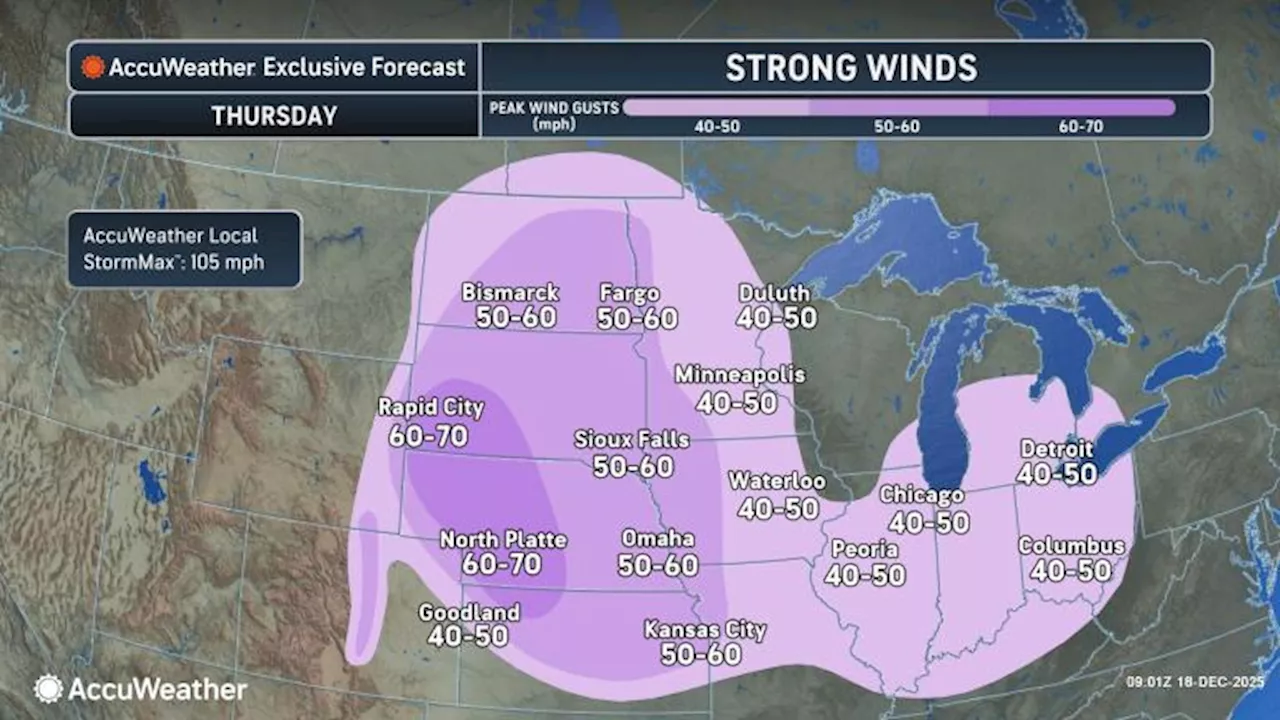
As winds transition into the Northeast, gusts are expected to remain strong, ranging from 50 to 70 mph across the Plains states from North Dakota to Iowa. This shift could cause sporadic power outages and significant travel delays at major airports. The AccuWeather Local StormMaxTM indicates potential gusts up to 105 mph, categorized as hurricane-force.
Officials warn that these winds, while less intense than those experienced in the Rockies, pose a serious risk of downed trees and power lines. In moist areas, trees may topple, while in drier regions, sparks from downed lines could ignite fast-moving wildfires. To mitigate this risk, some utility companies may initiate temporary power shutoffs.
Meanwhile, a new storm system is brewing, bringing additional high-powered winds from Montana to Colorado and northern New Mexico. Starting Thursday night, gusts are predicted to reach between 50 and 80 mph, with mountain areas seeing even higher gusts up to 110 mph. These conditions could lead to property damage and dangerous driving situations, with airlines likely to experience delays and cancellations, particularly in Denver.
Local ski resorts may face closures as strong winds and snow combine to create blizzard-like conditions, particularly in the northern Plains and Upper Midwest.
“Travelers should brace for significant disruptions as this storm moves through,”
warned meteorologists monitoring the situation.
As we approach Friday evening, winds will continue to shift eastward, impacting the Midwest and Northeast. Coastal areas will also see shifts in wind direction, increasing the risk of minor to moderate flooding during high tides.
Stay tuned for further updates as this storm system develops. Authorities are urging everyone in affected areas to remain vigilant and prepared for potential emergencies.