UPDATE: Seattle is bracing for significant weather changes as scattered showers and a dramatic drop in snow levels are forecasted for Friday, December 29, 2023. Residents should prepare for potential snowflakes in lowland areas as conditions shift overnight.
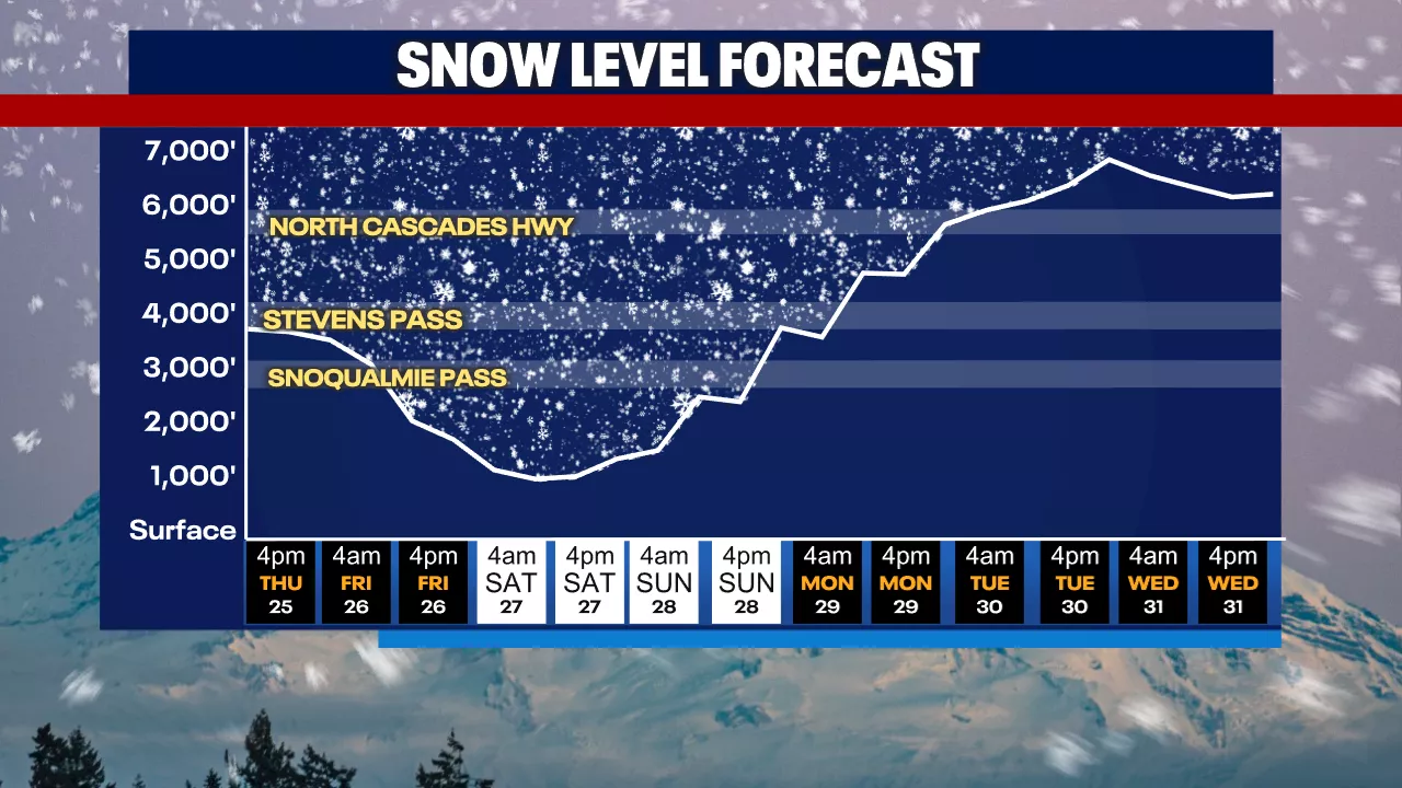
A Winter Weather Advisory will be in effect from 4 AM to 10 PM Friday, with snow levels expected to plunge to as low as 1000 feet by evening. This could lead to light snow accumulation across parts of the city, while mountain passes like Snoqualmie Pass and White Pass brace for 6-10 inches of snow.
The latest forecasts indicate that snow levels will start around 2500 feet Friday morning, dropping significantly as colder air moves in. While heavy snowfall is anticipated in the mountains, the moisture will largely dry out in lower elevations, minimizing any major snow events in Seattle itself.
As of now, temperatures will hover in the mid to low 40s Fahrenheit, a few degrees below the seasonal average. Winds are expected to gust up to 30 mph, but will remain below advisory levels.
Residents can expect cooler temperatures and drier skies by Saturday, December 30, with the possibility of more sunbreaks heading into early next week. However, the weather will shift again with mild conditions and scattered showers anticipated for the New Year.
Stay tuned for updates as this developing weather situation unfolds. For those traveling through mountain passes, caution is advised due to the challenging conditions expected throughout Friday.