UPDATE: Residents of Alabama brace for a chilly start to the work week as temperatures are set to plunge into the 30s and 40s tonight, following a cold front sweeping across the state. The National Weather Service has issued warnings for potential frost, particularly in north and central Alabama, causing concerns for outdoor activities and agriculture.
Today, scattered rain is expected, especially in northeast Alabama, where the highest rain chances will occur. Most of the state will remain dry, but cloudy conditions will keep temperatures cooler, with highs in the 50s for northern and central regions.
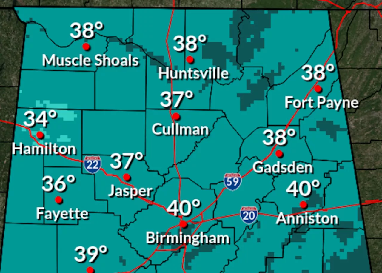
Tonight, as the cold air settles in, temperatures are forecasted to drop significantly, reaching lows of around 30°F in northern Alabama and the low to mid-40s in the southern parts of the state.
“Frost could be a concern for many areas, especially in the northern regions,”
warned meteorologists from the National Weather Service.
Looking ahead, the work week promises a dramatic turnaround in temperatures. Starting Tuesday, a warm-up is anticipated, with highs returning to the 60s and 70s by midweek and potentially reaching the low 80s by the weekend.
The forecast indicates that Friday could deliver statewide warmth, with temperatures ranging from the low 70s in the north to the upper 70s and low 80s in the south. No significant rain is expected until at least the end of the week, when minimal chances may arise for the northern regions.
Residents are encouraged to prepare for the drastic temperature fluctuations and stay informed about further weather updates. The Climate Prediction Center indicates a higher probability of above-average temperatures across Alabama from November 9-15, with the likelihood of warmth peaking in certain areas.
Stay tuned for the latest updates as this developing weather situation unfolds.