UPDATE: Staten Island residents should brace for significant weather changes tonight as dense fog and light rain are set to impact the area. The National Weather Service has issued an urgent alert for deteriorating conditions starting this evening.
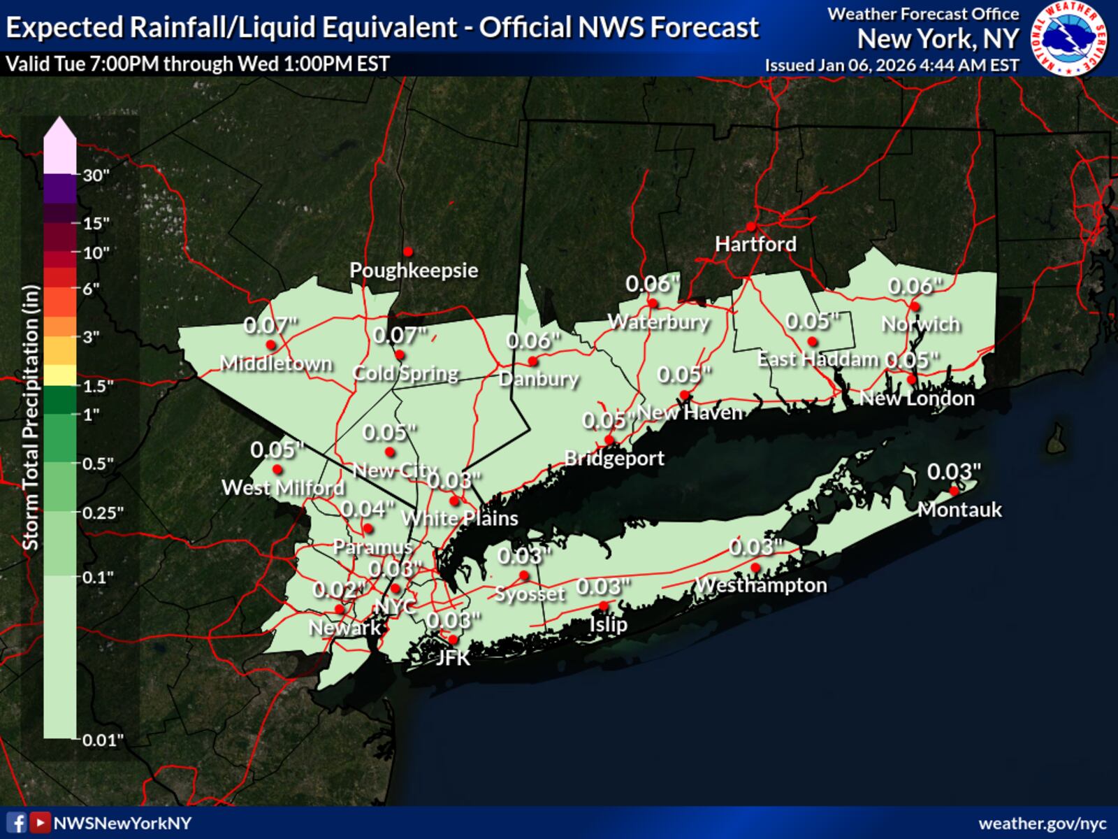
Residents should expect temperatures to hover in the upper 30s to lower 40s as fog begins to roll in after sunset. Visibility could drop dramatically, falling to a quarter mile or less overnight. The rain is anticipated to begin shortly after sunset, with total precipitation expected to be less than a tenth of an inch.
This weather event is linked to a low-pressure system moving north of the region late tonight into early tomorrow morning. While most of Staten Island will experience only rain, the National Weather Service warns that areas north and west of the city could face a brief period of freezing rain, potentially complicating travel.
As conditions improve on January 10, 2024, Staten Islanders can anticipate gradual clearing but should prepare for increased winds, with gusts reaching up to 25 mph. Highs will rise to the mid to upper 40s, which is about 5 to 7 degrees above normal for early January.
Looking ahead, a warming trend is expected through Thursday, with highs continuing in the 40s under high pressure. However, as a frontal system approaches, clouds are set to increase Thursday night.
This weekend, residents should prepare for another round of rain from Friday through Saturday, with temperatures soaring into the 50s before a drop in temperatures returns by the end of the weekend.
Stay tuned for further updates as this weather situation develops.